

The Conference will take place at:
Italian Geographic Military Institute
SAGAS-University of Florence
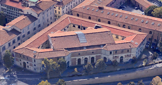
ITALIAN GEOGRAPHIC MILITARY INSTITUTE
The Italian Geographic Military Institute (IGMI) is the Army’s geographic supporting office. It is also the National Cartographic Authority according to the law n° 68/1960 and therefore the high quality cartography, produced by the institute and used by both public and private entities, is considered the official state cartography. In 1861, after the Italian unification, the IGMI began its activity as the Topographic Office of the Italian Army Staff, inheriting traditions and experiences from the topographic offices of three pre-Unitarian states: the Kingdom of the Two Sicilies, the Kingdom of Sardinia and, of course, the Grand-Duchy of Tuscany.
 Italian Geographic Military Institute
It was moved from Turin to Florence in 1865, it became the military topographic office in 1872 and ten years later it was named Italian Geographic Institute.
IMGI main activities are:
- Production, updating and sale of medium and small- scale cartography;
- High-resolution photogrammetric measurement of Italy;
- Set up and management of a geographic database;
- Maintenance, measurement and benchmarking of the state borders;
- Conservation of the National cartography.
- Personnel working at the Institute are involved in peacekeeping operations.